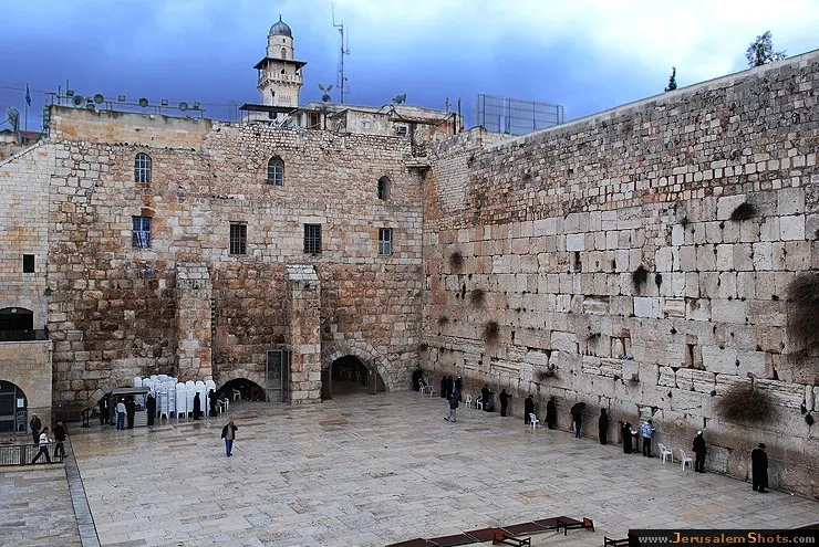
Kotel \ Western Wall
 © RomKri
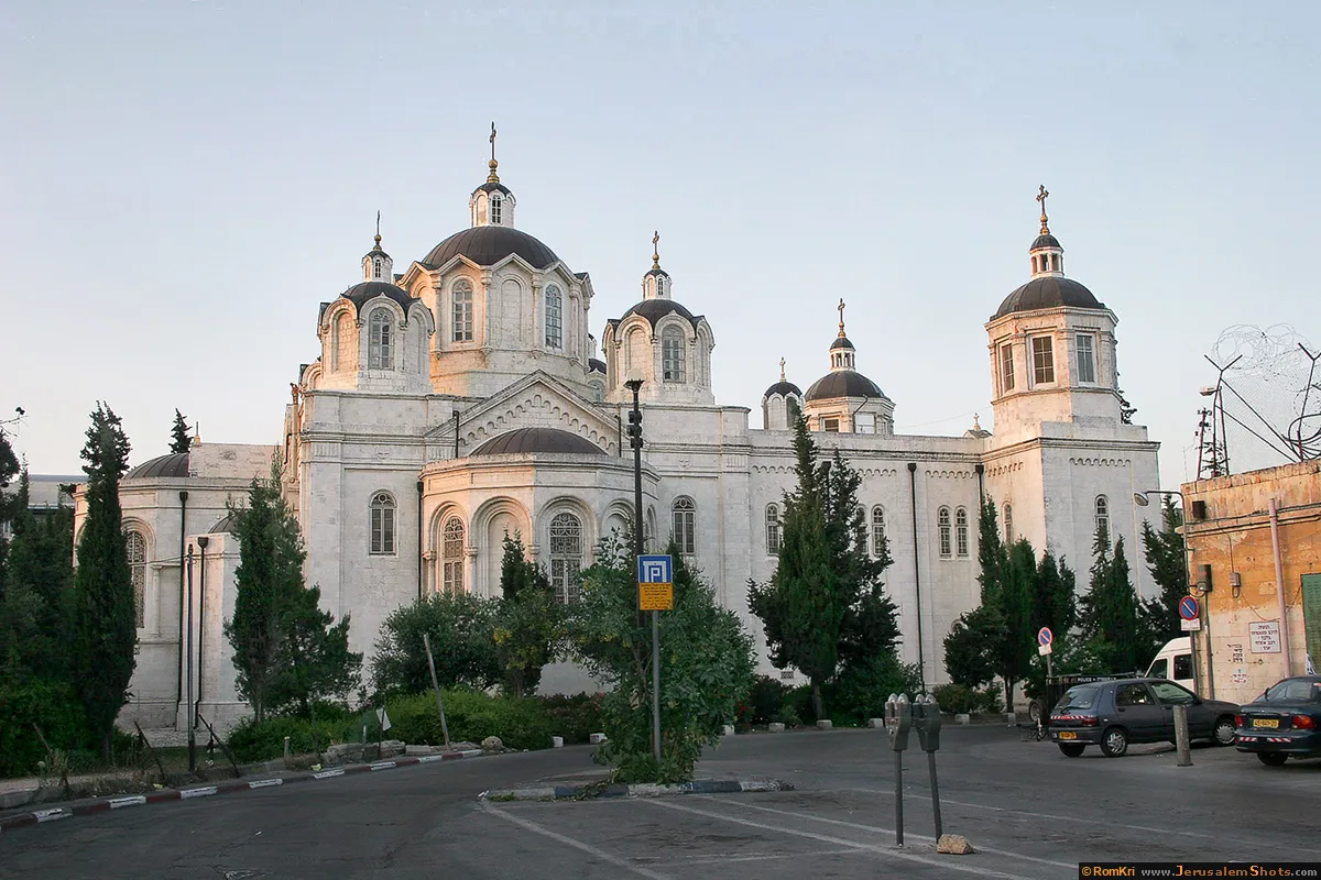
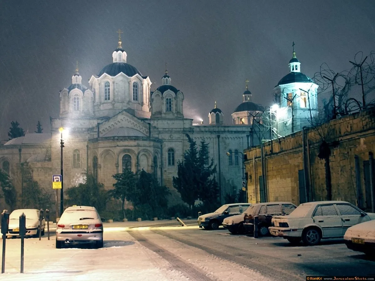
Holy Trinity Church - West Jerusalem (Russian Compound)
Kotel \ Jerusalem Day 2010 at Western Wall

Holy Trinity Church - West Jerusalem (Russian Compound)
Kotel \ Jerusalem Day 2010 at Western Wall

Kotel \ Jerusalem Day 2010 at Western Wall

Kotel \ Jerusalem Day 2010 at Western Wall

Kotel \ Jerusalem Day 2010 at Western Wall

Kotel \ Jerusalem Day 2010 at Western Wall

Jerusalem Hotels

 © Ron Peled
Kotel \ Jerusalem Day 2010 at Western Wall

Kotel \ Jerusalem Day 2010 at Western Wall

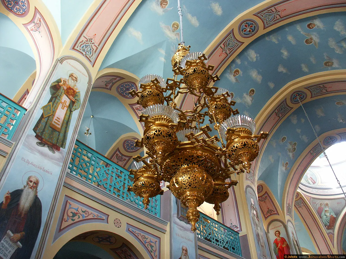
Holy Trinity Church - interior - West Jerusalem
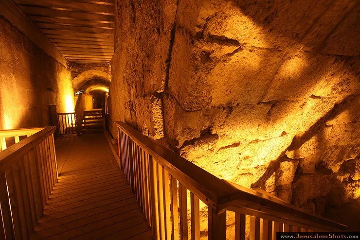
Kotel \ Western Wall Tunnel

Kotel \ Jerusalem Day 2010 at Western Wall

Kotel \ Jerusalem Day 2010 at Western Wall

Kotel \ Jerusalem Day 2010 at Western Wall

Kotel \ Jerusalem Day 2010 at Western Wall

Kotel \ Jerusalem Day 2010 at Western Wall

Kotel \ Jerusalem Day 2010 at Western Wall

Kotel \ Jerusalem Day 2010 at Western Wall

Kotel \ Western Wall Tunnel

Entrance into Western Wall

Kotel \ The Kotel ha maaravi (Western wall)

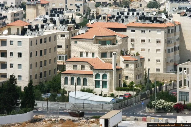
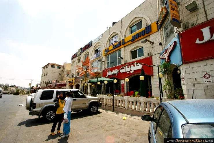
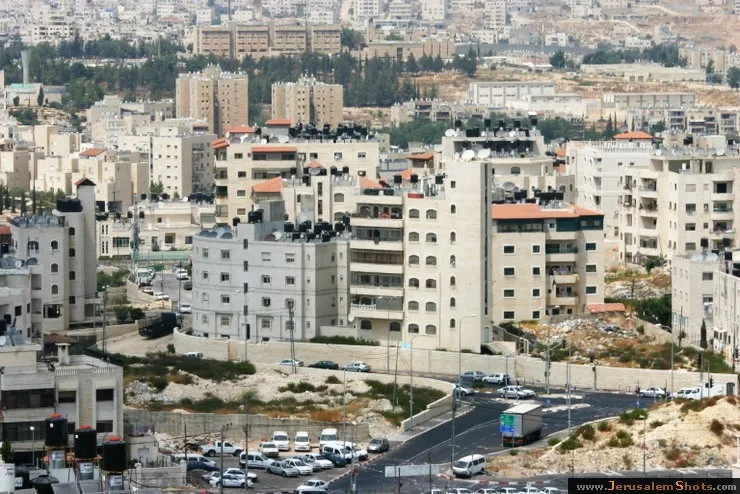
Beit Hanina, East Jerusalem

10.08.2009
Beit Hanina is a Palestinian neighborhood in East Jerusalem on the road to Ramallah. It is bordered by Hizma to the east, Shuafat to the south, Beit Iksa and Nabi Samwil to the west. The total area of Beit Hanina is 20 sq. kilometers (approximately 9 sq. miles). In 2007, Beit Hanina had a population of over 27,000.
Beit Hanina is a Palestinian neighborhood in East Jerusalem on the road to Ramallah. It is bordered by Hizma to the east, Shuafat to the south, Beit Iksa and Nabi Samwil to the west. The total area of Beit Hanina is 20 sq. kilometers (approximately 9 sq. miles). In 2007, Beit Hanina had a population of over 27,000.


 © Valery Dembitsky
Kotel \ The Western (Wailing) Wall

Kotel \ Jerusalem, Old City, Western Wall (Kotel)
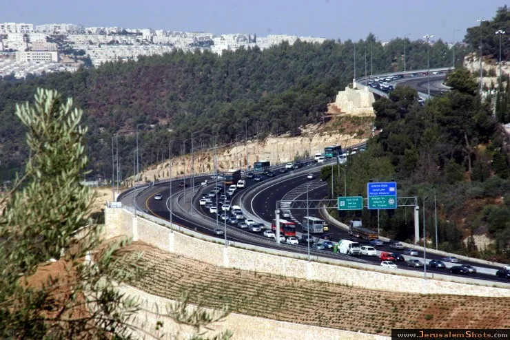
Highway No 1 Tel Aviv Jerusalem
20 July 2009
Highway No 1 is the main highway connecting Tel Aviv with Jerusalem. Highway continues into the occupied West Bank past the Israeli settlement of Ma'ale Adummim, and is then downgraded in size until the Beit HaArava Junction with Route 90 south of Jericho near the shores of the Dead Sea.
Highway No 1 is the main highway connecting Tel Aviv with Jerusalem. Highway continues into the occupied West Bank past the Israeli settlement of Ma'ale Adummim, and is then downgraded in size until the Beit HaArava Junction with Route 90 south of Jericho near the shores of the Dead Sea.
Beit Hanina, East Jerusalem
10.08.2009
Beit Hanina is a Palestinian neighborhood in East Jerusalem on the road to Ramallah. It is bordered by Hizma to the east, Shuafat to the south, Beit Iksa and Nabi Samwil to the west. The total area of Beit Hanina is 20 sq. kilometers (approximately 9 sq. miles). In 2007, Beit Hanina had a population of over 27,000.
Beit Hanina is a Palestinian neighborhood in East Jerusalem on the road to Ramallah. It is bordered by Hizma to the east, Shuafat to the south, Beit Iksa and Nabi Samwil to the west. The total area of Beit Hanina is 20 sq. kilometers (approximately 9 sq. miles). In 2007, Beit Hanina had a population of over 27,000.
Kotel \ Western Wall Tunnel
Kotel \ Jerusalem Day 2010 at Western Wall

Kotel \ Jerusalem Day 2010 at Western Wall

Highway No 1 Tel Aviv Jerusalem

20 July 2009
Highway No 1 is the main highway connecting Tel Aviv with Jerusalem. Highway continues into the occupied West Bank past the Israeli settlement of Ma'ale Adummim, and is then downgraded in size until the Beit HaArava Junction with Route 90 south of Jericho near the shores of the Dead Sea.
Highway No 1 is the main highway connecting Tel Aviv with Jerusalem. Highway continues into the occupied West Bank past the Israeli settlement of Ma'ale Adummim, and is then downgraded in size until the Beit HaArava Junction with Route 90 south of Jericho near the shores of the Dead Sea.
Kotel \ Western Wall Tunnel

Kotel \ Western Wall Tunnel

Kotel \ Western Wall Tunnel

Jerusalem from the southwest, between 1898 and 1914
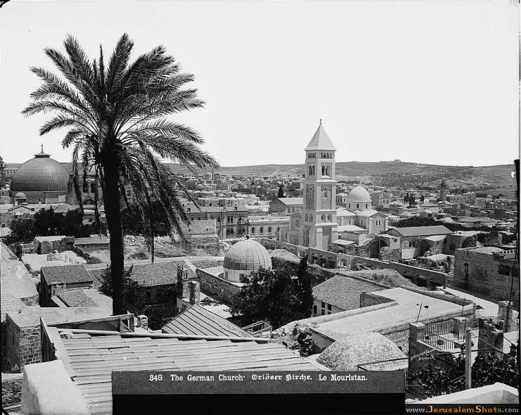
 © G. Eric and Edith Matson
Kotel \ Jerusalem Day 2010 at Western Wall
